Top 7 Tools for Automated Field Data Collection
Agriculture has moved beyond paper logs and spreadsheets. Today, automated tools simplify field data collection, improve accuracy, and save time. These tools leverage GPS, offline capabilities, and real-time data syncing to transform how farms operate. From tracking weather to mapping field boundaries, they help streamline workflows and reduce errors. They also provide navigation to exact field locations to prevent wasted time. Here's a quick look at the seven best options:
- HarvestYield: Great for GPS mapping, weather tracking, and simple data entry.
- Fulcrum: Offers geospatial data collection, offline syncing, and custom forms.
- FastField: Known for ease of use, AI-powered form conversion, and OCR features.
- GoAudits: Focused on inspections with geotagging and offline functionality.
- GoSpotCheck: Combines GPS check-ins with AI-driven image recognition.
- Forms on Fire: Transforms paper forms into digital workflows with offline reliability.
- KoboToolbox: Free, open-source tool ideal for remote or low-connectivity areas.
Each tool caters to different needs, from small farms to large-scale operations. Below is a comparison to help you choose the right one.
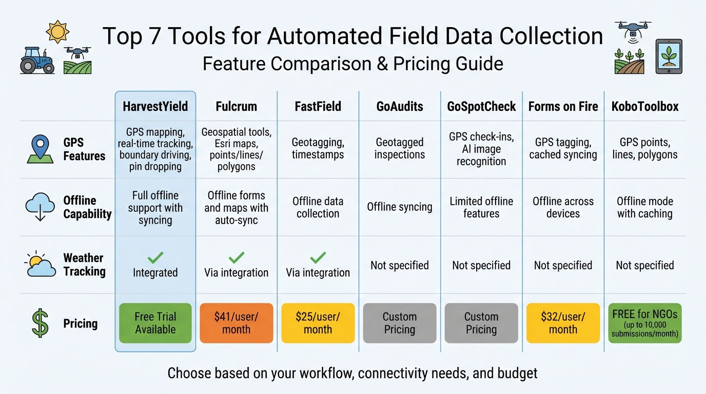
Comparison of 7 Automated Field Data Collection Tools: Features and Pricing
Automating Workflows for Field Data Collection
Transform Your Agricultural Team
Streamline job management, field mapping, and machine tracking with HarvestYield. Simplify your operations and eliminate paper job sheets.
ContinueQuick Comparison
| Tool | GPS Features | Offline Capability | Weather Tracking | Pricing |
|---|---|---|---|---|
| HarvestYield | GPS mapping, real-time tracking | Full offline support | Integrated | Starts at Free Trial |
| Fulcrum | Geospatial tools, Esri maps | Offline forms and maps | Via integration | $41/user/month |
| FastField | Geotagging, timestamps | Offline data collection | Via integration | $25/user/month |
| GoAudits | Geotagged inspections | Offline syncing | Not specified | Custom Pricing |
| GoSpotCheck | GPS check-ins, AI tools | Limited offline features | Not specified | Custom Pricing |
| Forms on Fire | GPS tagging, cached syncing | Offline across devices | Not specified | $32/user/month |
| KoboToolbox | GPS points, lines, polygons | Offline mode with caching | Not specified | Free for NGOs |
Choose based on your workflow, connectivity needs, and budget as you go paperless on your farm. Whether you need advanced mapping, simple forms, or free tools, there's an option to fit your digital record keeping needs and farm operations.
1. HarvestYield
HarvestYield is a job management tool designed for contractors, farm managers, and small farm owners. It simplifies fieldwork by automatically capturing data as tasks are completed, with job details accessible on any device.
GPS Integration and Accurate Geolocation
HarvestYield takes the guesswork out of location tracking by automatically tagging jobs with GPS data as tasks are completed. Need directions to a specific field? The platform offers turn-by-turn navigation to guide you right to the site. Operators can also map field boundaries by driving along perimeters or dropping pins on aerial imagery. Thanks to device GPS capabilities, location accuracy is typically within 1–3 feet.
To make things even better, the platform records real-time weather data alongside location information.
Weather Data Tracking for Reliable Records
HarvestYield doesn’t stop at location tracking - it also captures weather conditions in real-time whenever a job is logged. This feature ensures accurate records for activities like spray applications, certifications, and insurance purposes. The timestamped weather data is stored as part of the job’s permanent record, making it easy to reference later.
Designed for Simplicity in the Field
HarvestYield focuses on making life easier for field teams by reducing the need for manual data entry. Operators can quickly log material quantities - whether it’s spreadables, bales, or chemicals - with just a few taps. No more paper forms or trying to remember details back at the office.
The platform offers a 30-day free trial, no credit card required, with pricing plans that cater to everything from individual users to large teams.
2. Fulcrum

Trusted by nearly 3,000 companies and 50,000 users in over 100 countries, Fulcrum is a go-to platform for field operations. It specializes in capturing geospatial data, supports offline functionality, and allows users to create custom forms - no coding required.
GPS Integration and Geolocation Accuracy
Fulcrum automatically collects geospatial data and integrates with high-accuracy GPS units for enhanced precision. It can capture points, lines, and polygons, while also geotagging every photo and tracking team movements through video and audio recordings.
"We love the ability to do line and polygon sketches right in Fulcrum without having to use a third-party app. Keeping everything within the one app is great".
_ - Sean Kilpatrick, Senior Engineer at Brown and Caldwell_
This streamlined data collection process works just as well offline, ensuring uninterrupted operations in the field.
Offline Data Capture and Synchronization
Fulcrum’s offline capabilities are a game-changer. Field teams can access GIS layers and collect data - whether text, photos, videos, or audio - even without an internet connection. Once back online, all data syncs seamlessly to the cloud. For example, the Santa Barbara County Fire Department saw a dramatic improvement in property inspections after adopting Fulcrum in 2020. According to GIS Analyst Matt Marsh, the inspection rate jumped from under 50% to 90% annually.
Designed with Field Teams in Mind
Fulcrum is built to be user-friendly. Its drag-and-drop interface makes it easy to create custom mobile apps, and the AI-powered FastFill feature enables hands-free data entry through voice dictation. This saves field teams between 2 to 5 hours of manual work every day.
"We found Fulcrum to be really easy to work with. From the user side, it was always one of our favorite apps, if not the favorite".
_ - Holly Palmer, Senior Specialist Data Analytics at Southern California Edison_
Fulcrum also offers a 14-day free trial and consistently earns high ratings, ranging from 4.6 to 4.7 stars across various review platforms.
3. FastField
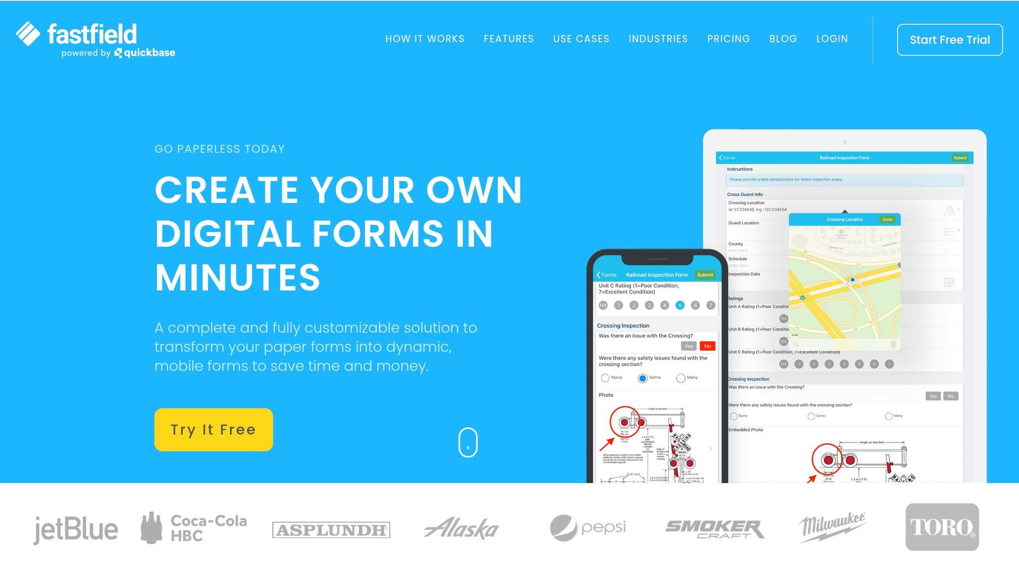
Zapier has dubbed FastField the "Best data collection app for ease of use". This platform combines GPS tracking, offline capabilities, and AI-powered tools to simplify field data collection, even in remote areas.
GPS Integration and Geolocation Accuracy
FastField automatically logs geolocation coordinates and timestamps with every form submission, ensuring the data's reliability. It takes location tracking a step further by linking all captured media - like photos, videos, and audio files - to specific GPS coordinates. This geotagging feature eliminates the need for manual input, reducing errors and saving time.
In addition to precise geolocation, FastField is designed to work seamlessly offline.
Offline Data Capture and Synchronization
Even in areas with no internet access, FastField stores data locally, complete with GPS details. Once connectivity is restored, the data syncs automatically to the cloud.
Ease of Use for Field Teams
FastField’s user-friendly interface requires no prior coding or technical skills. To make onboarding quick and simple, the platform includes tooltips, tutorial videos, and 24/7 support. A standout feature is the AI Form Converter, which can instantly turn paper forms or PDFs into digital formats. Additionally, the platform offers Optical Character Recognition (OCR) to extract text from labels and barcodes, automatically filling out form fields.
"FastField makes the entire data collection process easier, from designing and validating a form to the many options for creating and sending your data."
_ - Harry Guinness, Tech Writer, Zapier_
This thoughtful design prioritizes efficiency, streamlining every aspect of field data collection.
FastField is available for $25 per user, per month, offering unlimited forms and a 14-day free trial. It also integrates with tools like Quickbase, SharePoint, AWS, Google Drive, Dropbox, and Zapier.
4. GoAudits
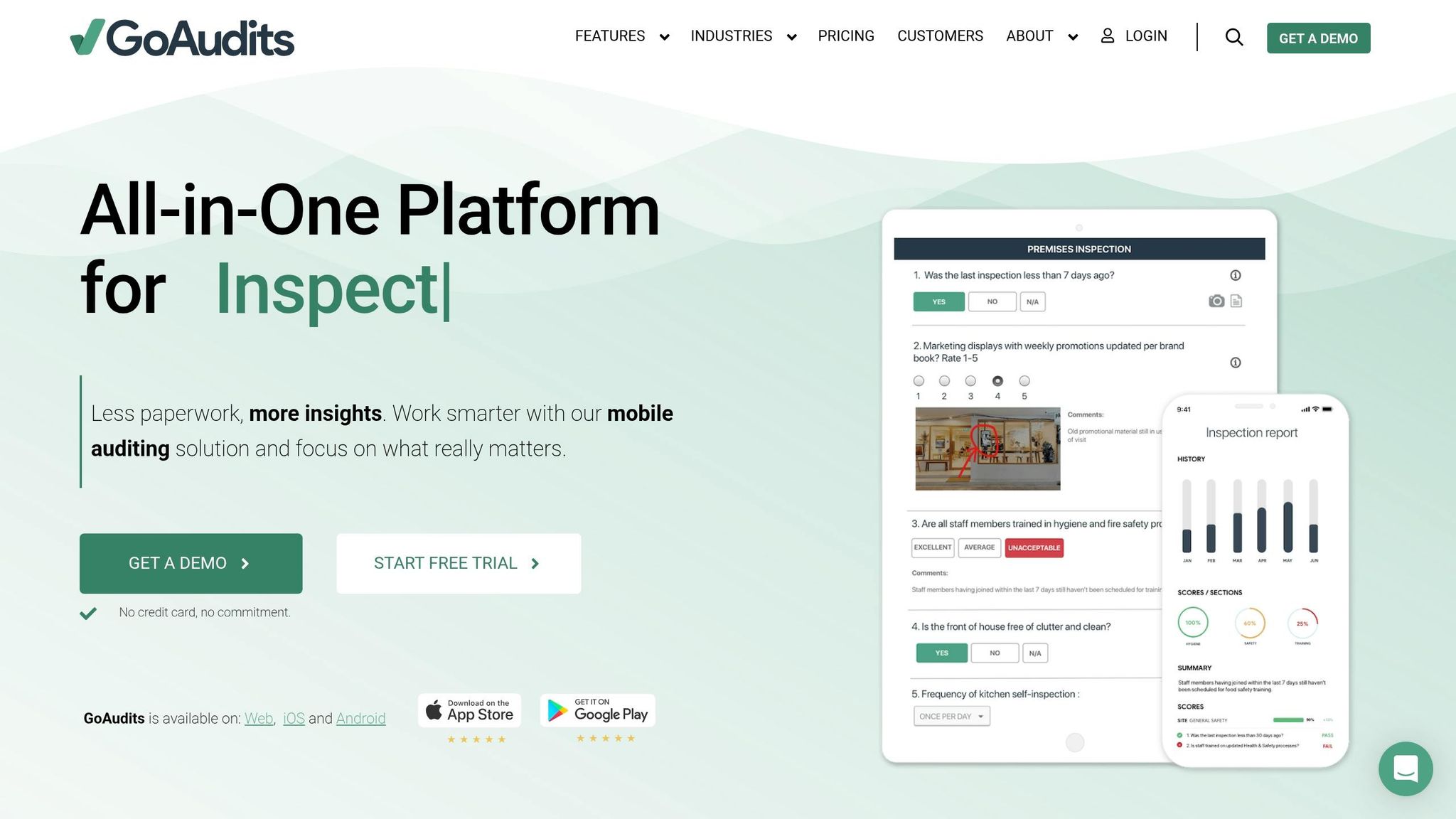
GoAudits is built for quick implementation, requiring no training to get started. Like other tools on this list, it simplifies field data collection while reducing the likelihood of manual errors.
GPS Integration and Geolocation Accuracy
The app automatically logs geolocation data and timestamps for every inspection, providing a clear audit trail. This automated geotagging not only saves time but also ensures accurate location tracking.
Offline Data Capture and Synchronization
Field teams can perform inspections offline, with data automatically syncing once the device reconnects to a network. This feature is especially helpful for teams working in remote areas with limited or no connectivity.
User-Friendly for Field Teams
GoAudits features an intuitive interface, allowing field workers to concentrate on gathering data without the hassle of navigating complex software.
5. GoSpotCheck
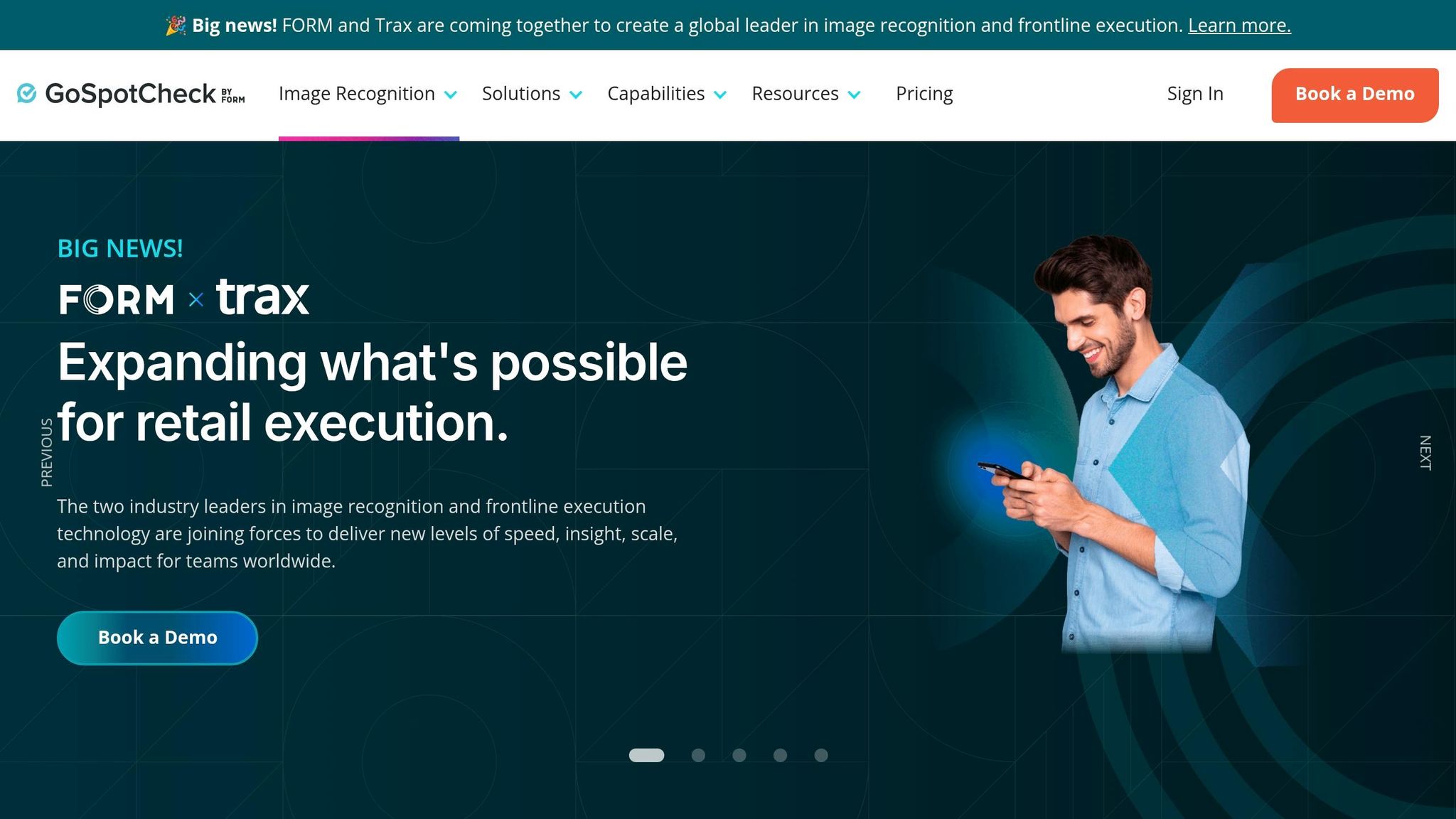
GoSpotCheck, now part of FORM, takes a location-focused approach to ensure field teams are where they need to be. Its GPS-based login and logout features verify store visits, making it harder to input data from anywhere other than the designated site.
By combining geolocation with AI-driven image recognition, the platform checks planogram compliance and confirms the presence of specific SKUs on shelves. A National Sales Transformation Director shared their experience:
"GoSpotCheck by FORM's image recognition delivers speed, accuracy, and almost zero manual input. Within minutes, we know our exact percentage of category and exact SKUs of every item in the cooler".
These tools are paired with a user-friendly interface tailored for field operations.
Ease of Use for Field Teams
The platform has earned a 4.1/5 star rating on Google Play from 1,540 reviews as of April 2026. Users appreciate its flexibility when answering questions and the simplicity of adding photos. Its mission builder includes conditional logic, which hides irrelevant questions based on prior responses, and administrators can set default values (like "0" for product counts) to make data entry quicker. However, some users have noted performance issues in areas with poor Wi-Fi or unstable network connections.
6. Forms on Fire
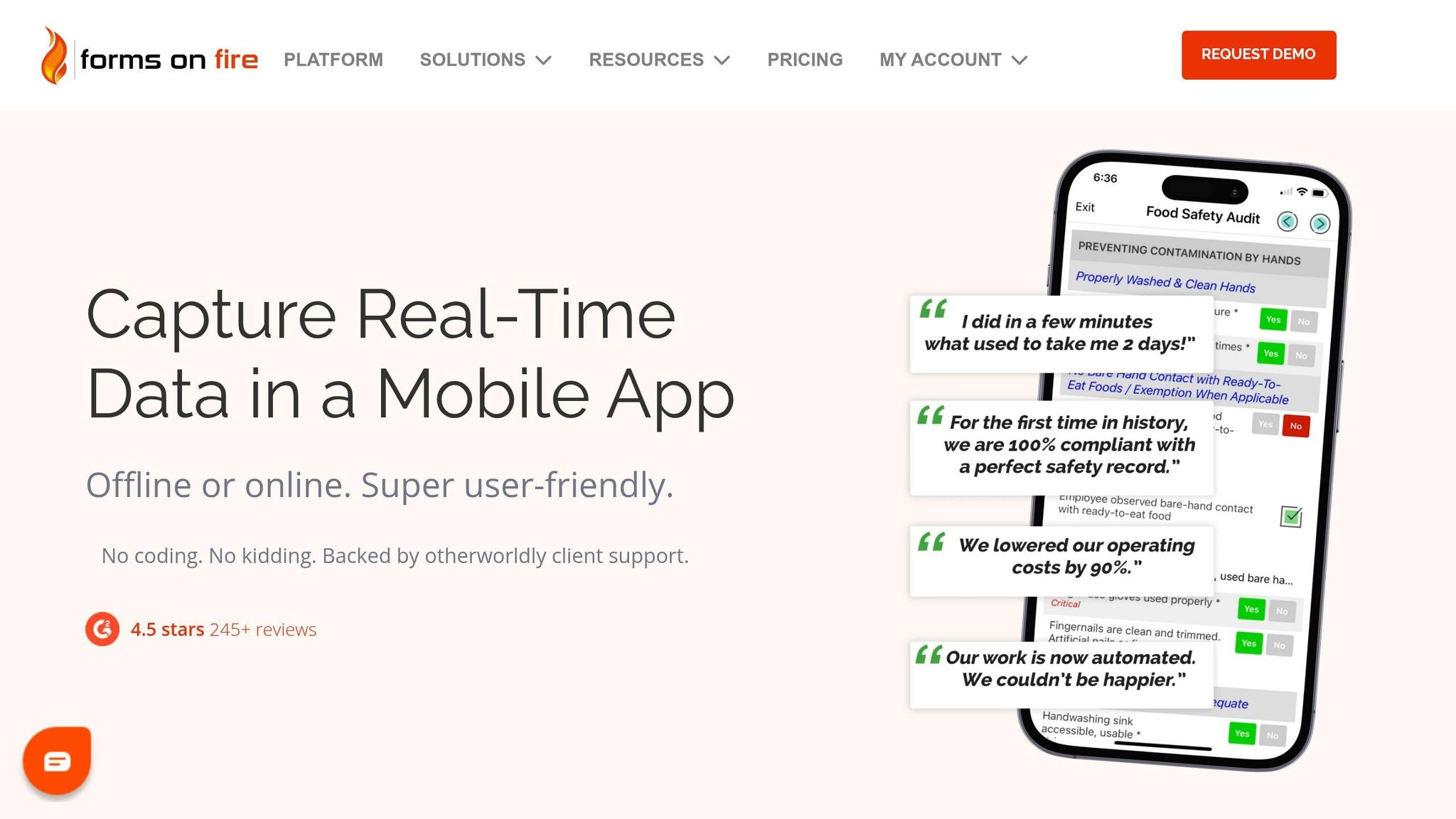
Forms on Fire stands out as a powerful tool for simplifying data collection in the field. It transforms paper-based processes into digital workflows with its AI-powered form builder and robust offline functionality. Field managers can create mobile forms effortlessly by either uploading existing PDFs or describing their needs, which the AI assistant then converts into a structured form layout.
GPS Integration for Accurate Geolocation
The platform leverages built-in GPS on devices to automatically tag and map form submissions with precise location data. This ensures every submission includes accurate geographic coordinates, creating a reliable audit trail for tasks like inspections and field services. Even when offline, GPS data is cached and synced as soon as connectivity is restored.
Offline Data Capture and Seamless Syncing
Forms on Fire keeps field teams productive across iOS, Android, and Windows devices by storing data locally and syncing it automatically to platforms like Google Drive, Microsoft 365, and Salesforce once back online. This eliminates the need for manual data entry, saving time and reducing errors. Reflecting on its impact, Matthew Maximo V. shared:
"Within the first 3 weeks of using FoF we were able to increase productivity and decrease paper to computer entry completely".
User-Friendly Design for Field Teams
The platform’s no-code, drag-and-drop builder - complete with Excel-style formulas and conditional logic - makes it easy for non-technical users to design and update forms without needing IT support. With over 245 reviews and a 4.5/5 star rating, users frequently highlight the platform's offline reliability and responsive customer support, which averages a 10-minute response time. Mohd R. commented:
"What I like most about Forms On Fire is how easy it is to create and manage forms... It is very reliable, especially when working offline. It saves a lot of time in organizing field data".
Pricing begins at $32.00 per user per month with annual billing, and a 14-day free trial is available. By combining intuitive form creation with dependable offline functionality, Forms on Fire streamlines data collection and enhances field operations.
7. KoboToolbox
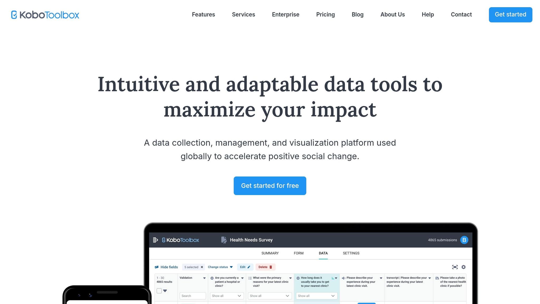
KoboToolbox stands out as a robust, open-source tool designed for use in tough environments. Trusted globally by over 32,000 organizations, it has processed more than 20 million forms across 220+ countries. Recognized by Zapier as the "best free data collection app", it offers its full suite of features at no cost to humanitarian organizations and allows up to 10,000 submissions per month for general users.
GPS Integration and Geolocation Accuracy
KoboToolbox supports three types of GPS data: Point (single coordinates), Line (geotrace), and Area (polygons). Its KoboCollect app ensures precise GPS data by providing real-time accuracy feedback. Forms can even be configured to wait for a specific accuracy level before saving the location. The system leverages multiple satellite networks - GPS, GLONASS, and A-GPS - for quicker signal acquisition and improved precision.
Offline Data Capture and Synchronization
One of KoboToolbox's standout features is its ability to function seamlessly in areas with little or no internet access. Using the KoboCollect Android app or Enketo web forms, data is stored locally on the device until a connection becomes available. The platform’s synchronization system bridges connectivity gaps without risking data loss. In completely offline zones, data can be transferred manually via USB using ODK Briefcase or through a local laptop server. Wai Yar Aung highlighted this capability, saying:
"Kobo not only streamlined our data collection during a critical time, but it also became a trusted platform for training community engineers".
Ease of Use for Field Teams
KoboToolbox is designed with ease of use in mind, offering swipe navigation, multi-language support, and the ability to save drafts. Field teams can collect data using the Android app or web forms on any device, including iOS and desktop computers. The platform also supports advanced form logic, like skip logic and validation criteria, to ensure high-quality data without constant supervision. Sharon Sagues from ICT4D shared:
"KoboToolbox is instrumental for our country teams, from timely technical support to usage insights that help us tailor our guidance for over 60 offices actively collecting data for lifesaving interventions".
For offline use of web forms, users should ensure the green checkmark appears in the top-right corner, confirming the form is properly cached before losing connection. This thoughtful design ensures reliable and accurate data collection, even in the most demanding field conditions.
Feature Comparison
Selecting the right tool hinges on which features are most important for your field operations. Below is a breakdown of how four popular platforms handle GPS capabilities, offline functionality, weather tracking, and user interface (UI) design - key considerations for effective field data collection.
| Tool | GPS Capabilities | Offline Functionality | Weather Tracking | UI Design |
|---|---|---|---|---|
| HarvestYield | Driving boundaries, pin dropping, RTK support | Full offline mapping and syncing | Integrated weather data | Mobile-first, with an agricultural focus |
| Fulcrum | Points, lines, polygons; Esri-based basemaps | Offline maps and forms with auto-sync | Via third-party integration | Drag-and-drop "App" builder |
| FastField | Geolocation, timestamping | Offline data collection | Via third-party integration | Intuitive with tooltips for every field |
| KoboToolbox | Point, line, and area capture; Enketo browser support | Offline mode for challenging environments | Not specified | Open-source, structured forms |
This comparison highlights how each platform tailors its features to suit specific operational needs, helping you make an informed decision for improving field data collection.
For instance, Fulcrum leverages Esri-based mapping technology, offering advanced geospatial tools for complex fieldwork. While many platforms depend on third-party integrations for weather tracking, HarvestYield stands out by automatically recording weather data with every task. All platforms support offline data collection, but the reliability of their mapping and syncing abilities varies.
Pricing also plays a crucial role in choosing the right tool. KoboToolbox offers a free tier allowing up to 10,000 submissions per month, making it an attractive choice for budget-conscious users. On the other hand, Fulcrum starts at $41 per user per month, while FastField provides unlimited forms for $25 per user per month. These differences in cost and functionality ensure there's an option to match your specific field management goals, enabling streamlined and automated data collection.
Conclusion
Choosing the right field data collection tool means finding one that aligns with your workflow and specific needs. For agricultural operations, HarvestYield stands out with its focus on integrated GPS mapping, real-time weather tracking, and machine cost management. By replacing paper job sheets and offering streamlined tools, it simplifies operations for farmers looking to boost efficiency.
Pricing is another key factor to weigh. Tools range from free options to professional plans tailored for teams needing advanced integrations. Deciding what fits your budget while meeting your requirements is crucial.
Your workflow also plays a big role - are you working with forms or maps? If structured inspections and compliance are your priorities, platforms like FastField or GoAudits might be better suited. On the other hand, HarvestYield shines for tasks involving spatial mapping and field boundary management.
For remote agricultural work, offline functionality is essential. While all seven tools support offline data collection, their syncing reliability and mapping features differ. HarvestYield provides full offline mapping and automatic weather data integration, making it a strong choice for fieldwork without consistent internet access.
Finally, consider your team size, data tasks, and integration needs. Smaller farms may benefit from straightforward, agriculture-specific tools, while larger operations often require advanced API connections to ERP systems. With its tailored design for agricultural teams, HarvestYield offers a scalable solution, transforming field data collection into a more efficient, automated process.
FAQs
How accurate is GPS field mapping on a phone or tablet?
Using RTK GPS, phones or tablets equipped for GPS field mapping can achieve an accuracy ranging from about 0.4 to 1.2 inches. This precision is ideal for carrying out detailed and accurate field mapping tasks.
What happens to my data if I collect it offline all day?
When you gather data offline throughout the day, it remains safely stored on your device until you reconnect to the internet. Many field data collection tools are designed with offline functionality, allowing you to record GPS coordinates, take photos, and complete form entries without needing an active connection. Once you're back online, the data automatically syncs to the cloud or a central system, keeping everything organized and updated while ensuring no data is lost during offline periods.
How do I choose the right tool for my farm’s workflow and budget?
To find the best tool for your farm, start by pinpointing what you need. Are you looking for features like GPS integration, weather tracking, or data analysis? Once you’ve got that figured out, think about your budget and the size of your operation. Smaller farms might do just fine with simpler tools, while larger setups may need more advanced platforms to handle the workload. Lastly, focus on tools that are easy to use and work well with your devices. The goal is to simplify your workflow while offering a good mix of features and cost-effectiveness.