Best Weather Dashboard Tools for Farmers in 2026
Farmers in 2026 have access to advanced weather dashboards that deliver precise, field-specific forecasts and actionable insights. These tools improve decision-making, cut costs, and reduce crop losses.
Here are the top tools:
- HarvestYield: Integrates weather data with farm workflows, offering GPS job tracking, automated schedule updates, and offline functionality. Plans start at $49/month for up to 250 active acres.
- Sencrop: Uses on-field weather stations for hyper-local data, ideal for spraying, irrigation, and disease management. Hardware starts at £380, with annual subscriptions from £150.
- Visual Crossing: Provides 15-day forecasts, historical data, and flexible API integration. Free and paid tiers available, great for tech-savvy users.
- DAWN Dashboard: Focused on Corn Belt row crops, offering seasonal forecasts and nutrient management recommendations. Low-cost or free via federal funding.
Quick Comparison:
| Tool | Key Features | Cost | Best For |
|---|---|---|---|
| HarvestYield | GPS tracking, job scheduling | Free–$379/month (by acreage) | Teams managing daily operations |
| Sencrop | On-field sensors, spraying alerts | £380+ hardware, £150/yr | Farms needing hyper-local data |
| Visual Crossing | Historical data, API integration | Free and paid plans | Tech-driven, data-focused farms |
| DAWN | Corn Belt-specific forecasts | Free/low-cost | Row crop producers in the Midwest |
Each tool excels in specific areas. Choose based on your farm's size, location, and operational needs.
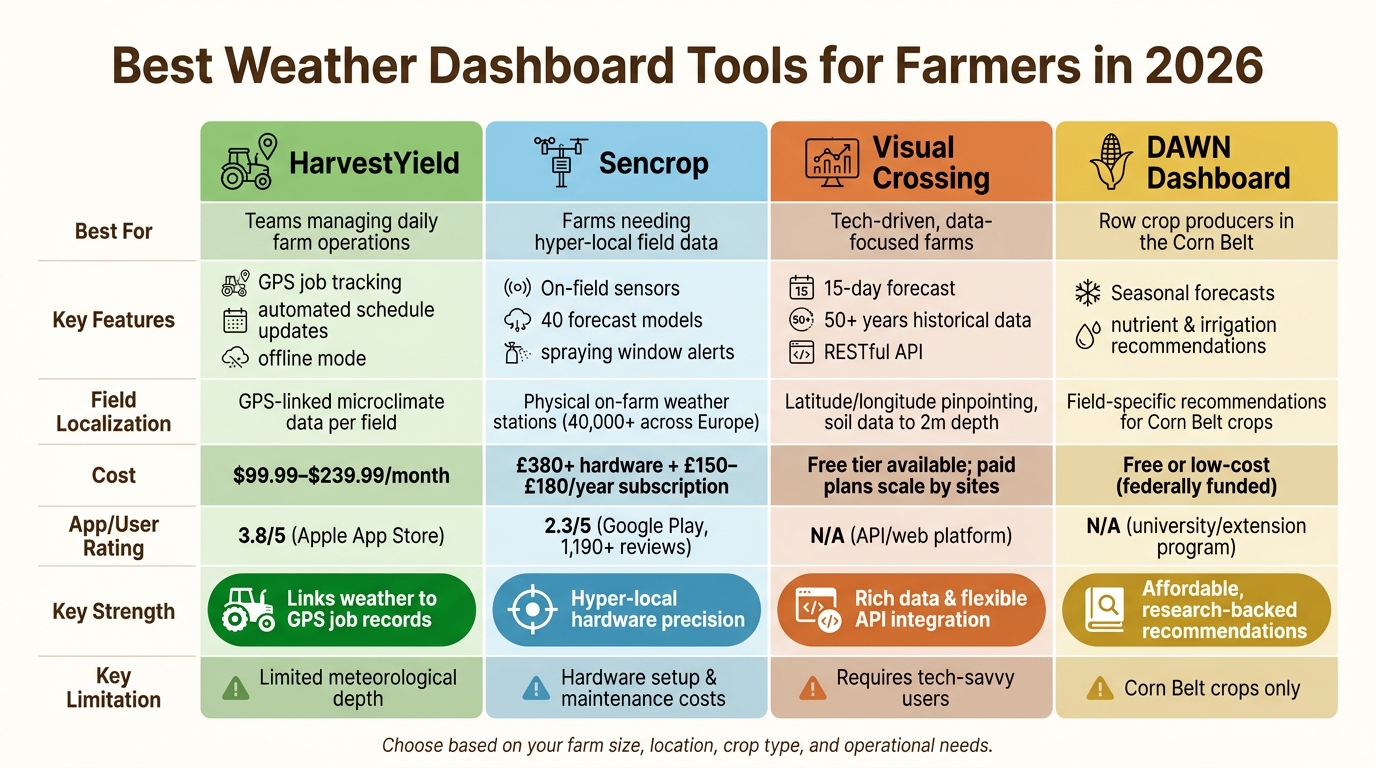
Best Weather Dashboard Tools for Farmers 2026: Side-by-Side Comparison
Precision Agriculture: How to Use Weather Forecast Data to Inform Your Crop Management
1. HarvestYield
HarvestYield is a job management platform designed specifically for agricultural teams, integrating weather data directly into daily farm operations.
Forecast Accuracy
HarvestYield utilizes Numerical Weather Prediction (NWP) models to provide field-specific weather guidance. When extreme conditions like frost, heavy rain, or intense heat are on the horizon, the system flags affected tasks and suggests rescheduling automatically - eliminating the need for manual monitoring. Operators can log real-time conditions, ensuring historical records reflect actual field data. Plus, the app functions offline, capturing data in low-signal areas and syncing it to the cloud once a connection is available. This feature is especially useful for farms in remote locations.
Field-Level Localization
Through GPS tracking, HarvestYield delivers microclimate data tailored to each field, linking weather conditions to specific GPS paths. Users on the Google Play Store, where the app has exceeded 5,000 downloads as of June 2026, frequently highlight GPS tracking and real-time team visibility as standout features.
This level of precise data collection integrates seamlessly into broader farm management systems, enhancing operational efficiency.
Integration with Farm Workflows
HarvestYield excels in connecting weather data with essential farm workflows. It streamlines processes like job scheduling, field mapping, machine cost tracking, and client management. For example, when a storm is forecast, the platform automatically updates job sheets, ensuring the entire team stays informed without a barrage of phone calls. Here's a quick breakdown of how its features improve daily operations:
| Feature | Workflow Benefit |
|---|---|
| Automated Schedule Adjustments | Reschedules tasks and issues updated job sheets based on weather forecasts |
| GPS Job Tracking | Links weather data to specific field locations and task records |
| Field Mapping | Outlines field boundaries, highlights irrigation points, and marks gate locations |
| Compliance Records | Provides GPS-stamped logs and material usage data for insurance or regulatory requirements |
Cost
HarvestYield prices by active acreage, so tiers scale with the land you work rather than the size of your team. Solo operators can start on the Free plan (up to 50 acres), which includes field mapping, machine logging, and cloud storage. Starter at $49/month covers up to 250 acres and adds job scheduling and updates. Larger operations can choose Pro at $149/month (up to 1,000 acres) or Business at $379/month (up to 5,000 acres), both with technical support. Every paid tier includes unlimited team members.
The platform has a 3.8/5 rating on the Apple App Store. Users often praise its offline functionality and GPS tracking but have mentioned wanting a clearer overview of total acreage across all mapped fields.
2. Sencrop Local Weather Dashboard
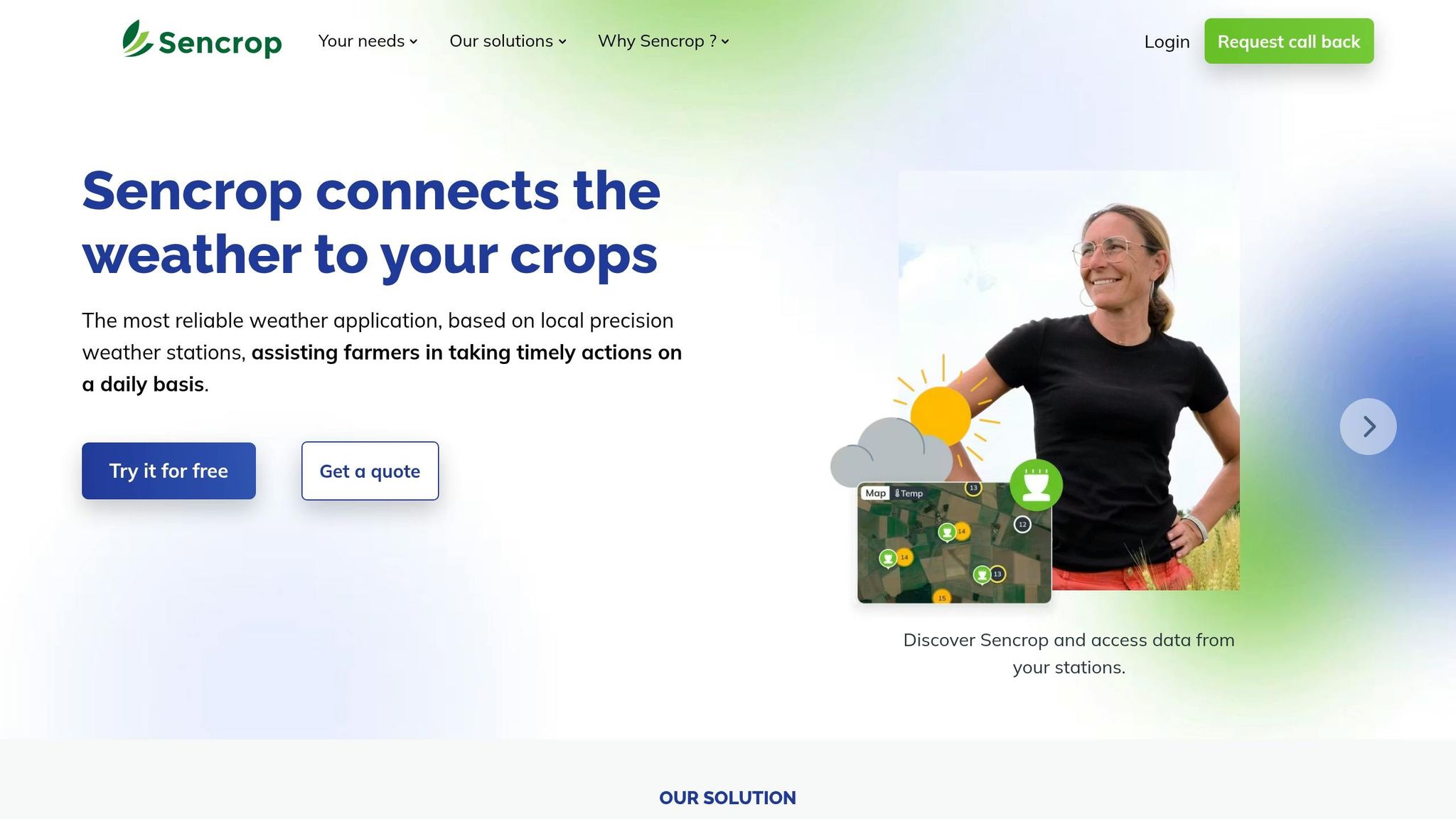
Sencrop is a precision weather platform from Europe that uses a network of on-farm weather stations to provide hyper-local, real-time data. Unlike services that depend on regional forecasts, Sencrop places its hardware directly in the field. By 2026, the company has installed over 40,000 weather stations across Europe.
Forecast Accuracy
Sencrop's "Sencrop Forecasts" feature combines data from 40 forecasting models, including the Met Office and BBC, and applies machine learning to create a customized 6-day forecast using historical trends. Data updates every 15–20 minutes through 4G, LoRa, or Sigfox networks, while triple sensors detect any unusual readings. The dashboard also includes a rain radar, offering animated views of precipitation, such as rain, snow, and hail, for the past two hours and the next two hours.
Beyond forecasting, Sencrop’s hardware provides highly localized, real-time weather insights.
Field-Level Localization
Sencrop's modular weather stations track essential metrics like rainfall, wind speed, soil moisture at various depths (4, 8, 16, and 24 inches), and leaf wetness - important for monitoring crop diseases. James Robinson, a farmer in Cambridgeshire, shared his experience using Sencrop units to manage a remote site 20 miles from his home:
"Knowing that it's too windy to spray at the remote site saves time and fuel." - James Robinson, Farmer
Integration with Farm Workflows
Sencrop seamlessly integrates with agronomic Decision Support Tools (DSTs) like Xarvio, Movida, and Rimpro, feeding its ultra-local weather data into pest and disease models. Its spraying window feature uses expert-defined thresholds (45–68°F, 60–95% humidity, and wind speeds below 6 mph) to notify users of the best times for applying treatments. Farmers can also set custom alerts for frost, leaching risks, or high humidity, delivered via SMS, email, or phone. Historical weather data can be exported in Excel or CSV format for further analysis.
| Feature | Benefit to Farmers |
|---|---|
| Spraying Windows | Recommends ideal times for spraying fungicides, herbicides, and insecticides |
| Integration | Connects local weather data with tools like Xarvio and Rimpro |
| Irricrop | Tracks water needs with up to 10 water balance calculations per station |
| Alert System | Sends real-time alerts for frost, leaching, and other risks |
| Data Export | Allows weather history and growing degree days to be downloaded |
These features streamline farm operations, helping farmers save time and resources.
Cost
Sencrop follows a dual pricing model: an upfront hardware cost and an annual subscription fee. Entry-level stations like the Raincrop start at about £380, while the more advanced Sencrop Plus bundle is priced around £699. Subscriptions cost approximately £150 per sensor annually, or £180 for the Plus tier. Data transmission fees are included in the hardware price, so there’s no need for separate SIM cards or cellular plans. Farmers can try the service with a 14-day free trial to evaluate coverage and forecast reliability.
On the Google Play Store, Sencrop has a 2.3/5 rating from over 1,190 reviews as of June 2026. Users praise its user-friendly interface and the ability to compare multiple forecast models. However, some have noted that the platform performs best in Central Europe, and the subscription cost may be a concern for some.
3. Visual Crossing Weather Dashboards
Visual Crossing offers a streamlined approach to farm weather management by combining data from NOAA, ECMWF, and the UK Met Office into a single 15-day forecast. The best part? There’s no need for upfront hardware investments.
Forecast Accuracy
By blending data from multiple meteorological organizations, Visual Crossing provides a unified and reliable forecast. Its 15-day forecast window is particularly helpful for managing harvest schedules and planning spray applications. For added value, the platform includes historical weather records spanning over 50 years, sourced from ground stations and satellites. This gives farmers a solid foundation for comparing current weather patterns with historical trends.
Field-Level Localization
Visual Crossing doesn’t stop at city or ZIP code-level data. Instead, it pinpoints specific fields using latitude/longitude coordinates. The platform also dives deep - literally - offering soil temperature and moisture readings down to 2 meters (around 6.5 feet). This is especially useful for planning planting schedules and monitoring germination conditions.
In addition to hyperlocal weather data, Visual Crossing includes agricultural metrics often overlooked by general tools:
| Metric | Farm Use Case |
|---|---|
| DeltaT | Determines the best spray windows by assessing evaporation rates |
| Growing Degree Days (GDD) | Tracks crop growth and predicts pest activity |
| Evapotranspiration (ET) | Optimizes irrigation schedules |
| Leaf Wetness | Assists in monitoring disease risks |
| Wet Bulb Temperature | Identifies heat stress risks for crops and livestock |
This level of detail ensures farmers get actionable insights tailored to their specific needs.
Integration with Farm Workflows
The platform’s data can be accessed through a RESTful API in JSON or CSV formats, making it easy to integrate into custom farm management software or even simple spreadsheets. Visual Crossing’s Multi-Site Weather Risk Monitor dashboard is another standout feature. It tracks thousands of field locations simultaneously, using color-coded alerts based on custom thresholds like high winds or freezing temperatures.
"Agricultural operations depend on clear, hyperlocal weather data at each step of the process... agricultural professionals need real-time insights both above and below ground." - Visual Crossing
A handy tip: Use the "Preview" feature in the Risk Monitor to test custom alert settings on a small scale (up to 5 sites) before applying them across all locations. This helps avoid errors that could impact critical decisions.
Cost
Visual Crossing offers a free tier that allows users to query both forecast and historical data without requiring a credit card. Paid plans, which scale based on the number of monitored sites, unlock additional features and higher location limits. For now, during the 2026 preview release, the Weather Risk Monitor is included in all subscription plans at no extra cost. Interested users can also request agricultural trials after signing up.
This platform is ideal for farms with a tech-savvy team or software-driven workflows. However, those looking for plug-and-play hardware solutions with physical sensors might find it less straightforward than platforms built around on-site weather stations.
Transform Your Agricultural Team
Streamline job management, field mapping, and machine tracking with HarvestYield. Simplify your operations and eliminate paper job sheets.
Continue4. DAWN Dashboard For Corn Belt Decision Support
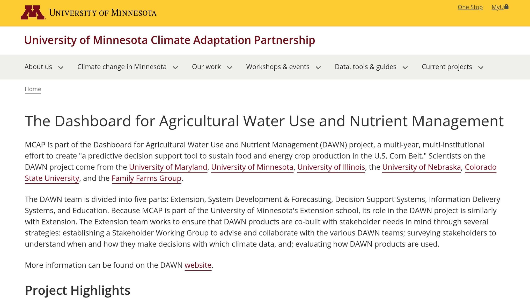
The DAWN Dashboard (Dashboard for Agricultural Water and Nutrient Management) is tailored specifically for Corn Belt row crops, helping farmers make better water and nutrient management decisions. This tool is the result of a collaborative effort involving the University of Maryland, University of Minnesota, University of Illinois, University of Nebraska, Colorado State University, and the Family Farms Group, all supported by a USDA National Institute of Food and Agriculture (NIFA) grant (Grant No. 2020-68012-31674).
Forecast Accuracy
DAWN uses cutting-edge regional forecasting systems combined with an advanced risk analysis engine to deliver seasonal forecasts that help farmers make informed decisions about planting and nutrient management.
"DAWN empowers farmers to make decisions based on accurate seasonal forecasts rather than historical trends." - Guillermo Balboa, Nutrient Management and Digital Agriculture, University of Nebraska-Lincoln
This forward-thinking approach is especially valuable for determining planting windows and managing nutrient applications before conditions change.
Field-Level Localization
Unlike tools that provide broad regional insights, DAWN translates climate predictions into field-specific recommendations. It focuses on the critical decisions row crop producers face, such as when and where to plant, how to manage irrigation effectively, and how to apply nutrients efficiently while reducing environmental impact. A Stakeholder Working Group ensures that the tool aligns with the needs of farmers and their advisors.
Integration with Farm Workflows
DAWN functions as a standalone decision-support tool, structured around five core teams: Extension, System Development & Forecasting, Decision Support Systems, Information Delivery Systems, and Education. This setup ensures continuous improvement to meet real-world agricultural challenges. While its focus on Corn Belt row crops is a strength for producers in that region, it may not fully address the needs of farms with diverse crops or those outside the Corn Belt.
Cost
Thanks to federal funding, DAWN is available at a low cost or even free. Farmers should check with participating university extension programs for the latest subscription details. While tools like DAWN offer affordable access, there’s still room for wider adoption in everyday farm operations.
Pros and Cons
This section breaks down the main advantages and drawbacks of each weather dashboard tool, summarizing insights from the detailed reviews above. Choosing the right tool is crucial - picking one that doesn’t align with your needs can lead to inefficiencies and missed opportunities.
HarvestYield is ideal for teams that need to link weather data directly to job records. By automatically logging weather alongside GPS-tracked job sheets, this platform simplifies data management for farm managers overseeing multiple crews. However, its focus on job management means it’s not the go-to choice for detailed meteorological analysis or long-term forecasting. Pairing it with a specialized weather tool is a smart move for those deeper needs.
Sencrop shines when hyperlocal precision matters, thanks to its network of field stations. This makes it perfect for farms where micro-climate variations significantly impact decisions. The downside? It relies on hardware, which comes with setup and maintenance costs - potentially challenging for smaller operations.
Visual Crossing caters to data-savvy users, offering extensive historical weather data and flexible API integration. It’s a great choice for those building custom tools or needing raw data access. However, it’s less appealing to farmers looking for ready-to-use agronomic decision-making support.
DAWN is tailored to Corn Belt row crop producers, providing field-specific nutrient and irrigation recommendations backed by university research. Its federal funding keeps costs manageable, but its focus on a specific region and crop type limits its usefulness for farms outside the Corn Belt or those growing a variety of crops.
| Tool | Key Strengths and Limitations |
|---|---|
| HarvestYield | Strengths: Links weather to job records, GPS-tagged locations, job scheduling. Limitation: Lacks detailed meteorological tools. |
| Sencrop | Strengths: High accuracy from station-level data. Limitation: Hardware costs and upkeep. |
| Visual Crossing | Strengths: Rich historical data, flexible APIs, free tier available. Limitation: Requires tech-savvy users; limited ready-made agronomic tools. |
| DAWN | Strengths: Affordable, field-specific recommendations. Limitation: Restricted to Corn Belt row crops. |
The bottom line? Each tool has its niche. Farms with active crews will benefit from tools like HarvestYield that integrate weather into daily tasks. Corn Belt producers focused on seasonal strategies will find DAWN invaluable. Meanwhile, operations needing raw data flexibility will appreciate the affordability and scope of Visual Crossing. The key is understanding your farm’s priorities to choose the best fit.
Conclusion
Selecting the right tool comes down to understanding your everyday needs.
For teams managing contractors or field workers, HarvestYield provides a seamless solution by combining weather data with GPS-tracked job records. This means weather conditions are automatically logged and linked to specific field activities, eliminating the need for manual data entry. While it’s not built to function as an in-depth meteorological tool, HarvestYield shines in simplifying operations and boosting accountability.
FAQs
How do I pick the right weather dashboard for my farm?
When selecting a weather dashboard for your fields, focus on one that provides hyper-local data rather than general regional forecasts. This ensures the information is tailored to your specific location. Features like automated alerts for crucial tasks - such as spraying, irrigation, or frost protection - can help you save resources and minimize waste.
It’s also smart to choose a tool that combines weather insights with your farm data, like soil moisture levels or crop growth stages. This integration makes decision-making more precise and effective. Lastly, access to historical weather data is invaluable for identifying patterns and improving planning over time.
Do I need on-farm sensors, or are forecasts enough?
Regional forecasts can give you a general idea of weather patterns, but they often overlook the specific microclimates that directly impact your farm. On-farm sensors step in to fill this gap by providing real-time insights into soil moisture, leaf wetness, and localized temperature. This data empowers you to make informed decisions about irrigation, pest management, and frost protection - right when it matters most. Pairing these sensors with tools like HarvestYield allows you to dive deeper into your field conditions, offering actionable insights that enhance both efficiency and yield consistency.
How can weather data tie into job scheduling and field records?
Weather data plays a key role in connecting field activities to real-time conditions. By combining forecasts with historical trends, you can establish specific thresholds - such as wind speed for spraying or soil temperature for planting - that help with scheduling and send timely alerts. HarvestYield takes this a step further by logging precise weather information and GPS coordinates for each task. This not only ensures compliance-ready records but also allows you to adapt your plans to reduce risks and improve farm efficiency.